Ente Parco Delta del Po Veneto (VenetoPark)

Play Video

The Po Delta is the biggest wetland in Italy and one of the most important in Europe.
Since the 2015 it is part of the UNESCO world network of Biosphere Reserves of the program MaB which focuses on the improvement of the relation between man and environment and on limiting the loss of biodiversity.
This is a land where men have to work constantly to maintain natural environments. This is why we call it “an artificially natural” or “a naturally artificial” place. This territory is in fact the result of centuries of land reclamation skilled works.
The environment is an alternance of different landscapes from the river to the sea: fossil dunes, pinewoods, river banks, flood plains, fishing and natural lagoons, sandbars very rich in the presence of birds. In the Po Delta you could see more than 390 different species of birds.
It has 7 river branches on a surface of over 700 km2, including: 160 km2 of fishing lagoons, natural lagoons and sandbars; 123 km2 of fossil dunes and ancient river beds.
The Delta is growing almost 70 mt every year because of the sedimentation activity of the river and this is why this is also called the youngest land of Italy.

The Delta is generally divided into two parts corresponding to its younger part, called “Active Delta”, and to its most ancient part, called “Fossil Delta”.
The Active Delta is the result of the river flow since 1604, that is when the people of Venice performed the so-called “Taglio di Porto Viro” (Porto Viro Cut-Off), the waterworks deviating the course of the river Po towards the south. The waterworks were built were today Taglio di Po rises, a town recalling with its name that measure.
The Active Delta is therefore the most recent territory in the Po area, and represents the stretch involving Parco Regionale Veneto and consisting of five main branches and other minor branches.

From Po Grande or di Venezia, Po di Maistra branches out in the north (since it is controlled by the lock of Volta Grimana, Po di Levante can no longer be considered an active branch); Po Piccolo or di Goro, Po della Donzella or Gnocca, and Po delle Tollebranch out in the south. In its final stretch, Po di Venezia is called Po di Pila, branching off into Busa di Tramontana in the north and Busa di Scirocco in the south; in the point towards the sea, the river Po is called Busa Dritta and flows into Punta Maistra, where you will find Pila Lighthouse.

The Fossil Delta begins in the south of Po di Volano, where the Po Delta was situated in the Middle Ages. This area is no longer crossed by the active branches of the river.

The Po Delta is also known as the “land of water” because of its river brances and because of the several natural and fishing lagoons.
A fishing lagoon is a brackish environment where the inflow of fresh and salted water is artificially regulated by sluice-gates (locks). Created by man, the fishing lagoon is an extensive fish farming, where the fish naturally grows in three, four years. The word “valle” – the Italian word for “fishing lagoon” – derives from the Latin “vallum”, that is the banks built to delimit these areas. To catch the fish in the fishing lagoons, it is necessary to wait for the period of the so-called “montata”, when in summer the young fish moves from the sea to the lagoons, because it finds here more nourishment and warmer waters.

 Nets are placed in the passageways and enable to seize it: this system was already used by the Romans, who called the lagoons “piscinae piscariae”. Fishing lagoons are not only characterized by the beauty of the landscape, but also by typical buildings: the “cason de vale”, with the big semi-circular chimney, the dwelling place of the owner and shelter of the guardians; the “casonetto”, a premise used as a shelter for tools, and the “cavana”, a roofed-over mooring place for boats. In the Delta there are 24 fishing lagoons covering 3,000 hectares in the Municipality of Rosolina, 3,500 in the Municipality of Porto Viro, and 1,650 in Porto Tolle.

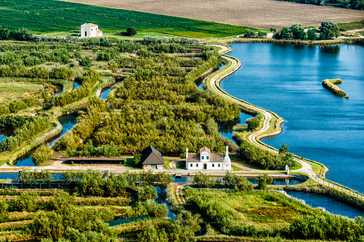
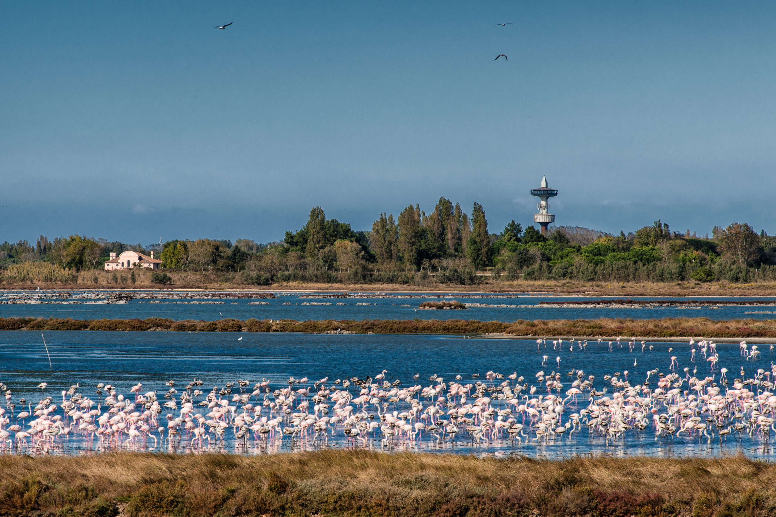
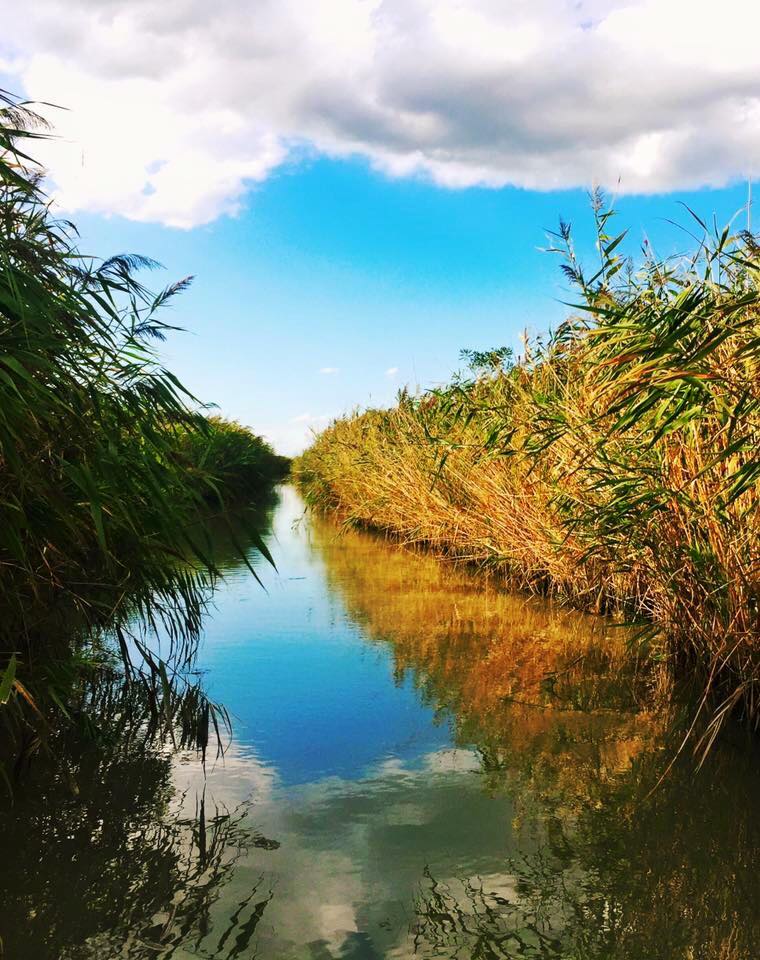
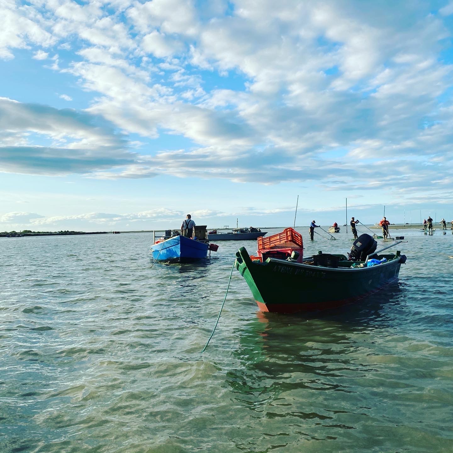
The lagoon is a basin of brackish water, in some points reaching only a few centimeters of depth, delimited towards the sea by sandy dune bars or sandbars and, on the side of the river, by tidal flats consisting of banks of silt or sand periodically submerged by the tides, and by shoals, that is muddy holms of sedimentary origin.
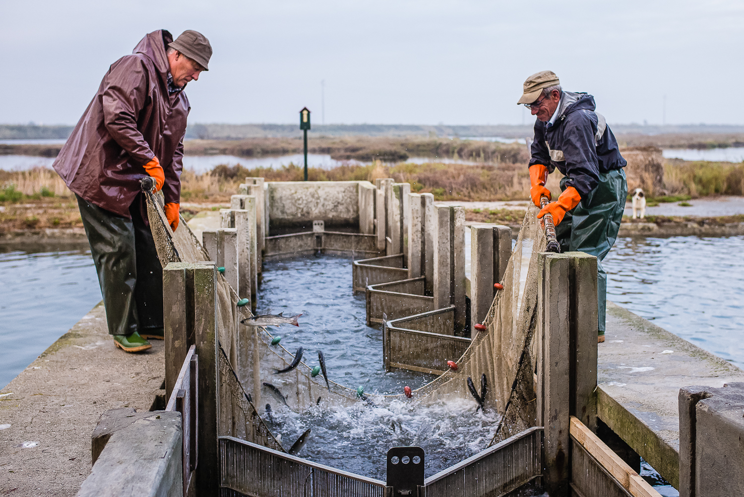
Where the sea can penetrate with its waves, there are brackish inlets forming: they are uniform and shallow stretches of salted water delimited by river branches. Both in the lagoons and brackish inlets mussels and clams are farmed, fishing is practiced, and the “novellame” – small fish farmed in the lagoon – is caught.
The lagoons of the Po Delta are 7: Caleri, Vallona, Barbamarco, Batteria, Burcio, Basson, and Bonelli Levante; the brackish inlets are 2: Sacca Canarin and Sacca degli Scardovari.

The Park Authority, established by L.R. (Regional Law) n. 36/1997, has the purpose to protect, recover, enhance and preserve the natural, historical and cultural characteristic of the Po Delta area, as well as ensuring adequate promotion and protection of the characteristic economic activities of the area and contributing to the improvement of the quality of life of local communities.

The Park Authority successfully implemented the LIFE09NATIT000110 “Conservation of habitats and species in the Natura 2000 sites in the Po Delta” dealing with habitat and species conservation of Habitat Directive in the transitional waters of the delta.

Our Staff

Every one of our team members is devoted to delivering the finest possible designs.