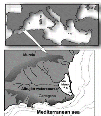
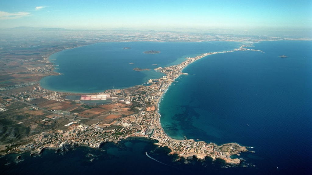
The Mar Menor is a hypersaline coastal lagoon, with a surface of 135 km2, a perimeter of 59.51 km, and a mean depth of 3.6 m and maximum over 6 m. It is located in the South-western Mediterranean coastline (37º42’00” North – 00º47’00” West). “La Manga”, a sandy bar 22 km long and 100 to 900 m wide, acts as a barrier between the lagoon and the Mediterranean Sea. It is crossed by five more or less functional inlets called “golas” which connect the lagoon with the sea. Four are shallow and one of them, “El Estacio”, was widened and dredged to make it a navigational channel. The lagoon waters’ salinity ranges between 42 PSU and 50 PSU and the temperature varies from 10ºC in winter to 32ºC in summer.
The bed sediment grain size composition is predominantly muddy and sandy, with some areas of natural rocky bottoms around islands and some calcareous and volcanic outcrops.
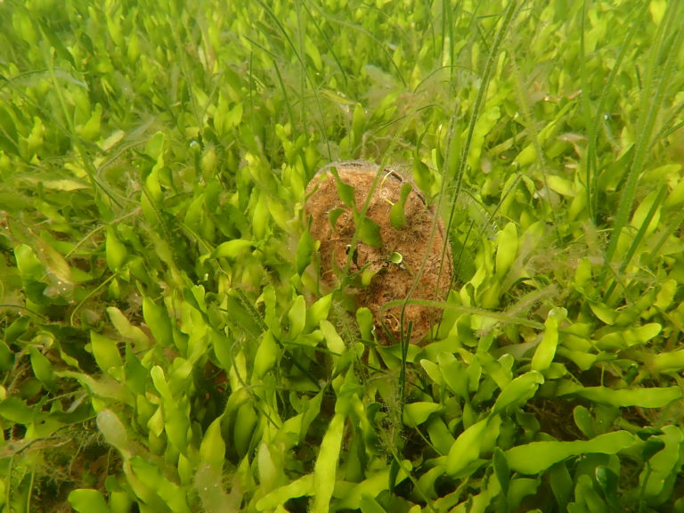
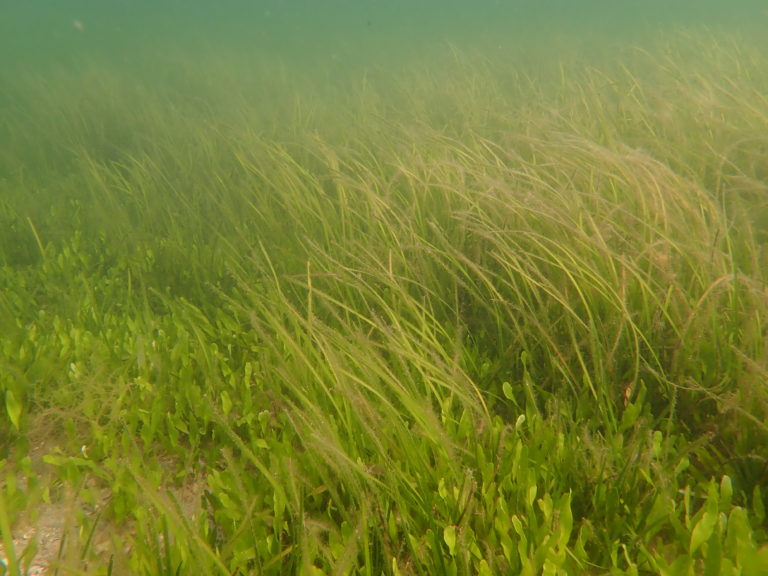
- Muddy bottoms, which cover both the whole central area of the lagoon and the shallow zones showing lower hydrodynamics, are covered by a dense meadow of the algae Caulerpa prolifera or patches of the sea grass Ruppia cirrhosa.
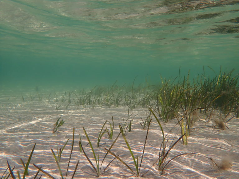
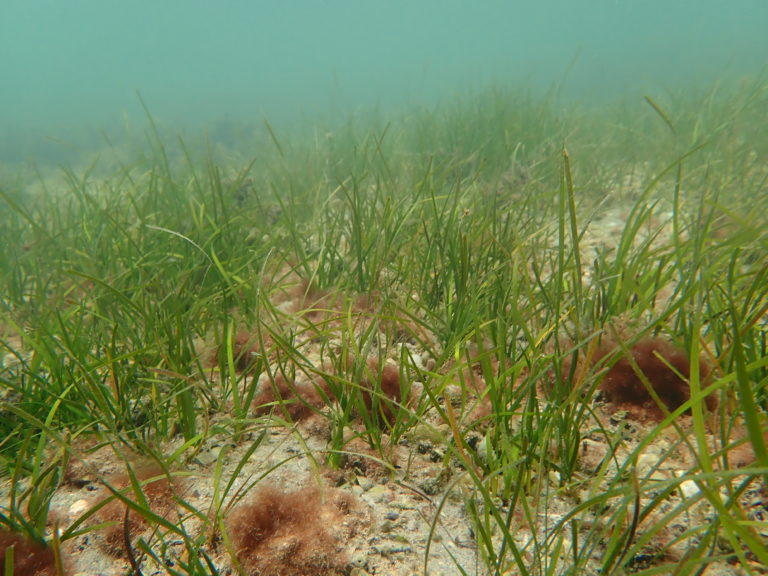
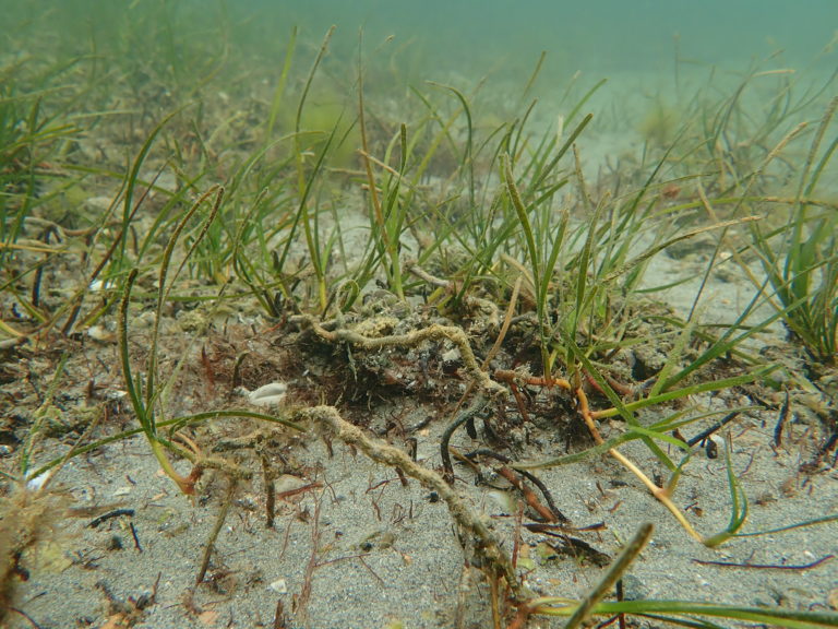
- Sandy bottoms (with sand content up to 89%) are located at the margins of the basin and in the small bays surrounding the islands, in which sparse patches of the phanerogame Cymodocea nodosa grows.
From an ecological perspective, Mar Menor differs from other Mediterranean coastal lagoons: its size, depth, bottoms, being of rocky substrates related to the volcanic outcrop and docks and the mediterraneization process related to increased water interchanges can explain most of its species richness and actual bionomic diversity.
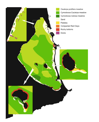
Modified from Pérez-Ruzafa et al. (2019).
The Mar Menor has great socio-economic importance and supports a wide range of uses. It is considered a key factor in regional development plans providing key tourist and recreational services and maintaining important fisheries communities.
The lagoon is, however, a subject of concern due to its high rate of change over recent decades with a detrimental impact on the structure of its biological assemblages and dynamics. Some of the changes have been induced by coastal work on tourism facilities (land reclamation, opening and extending channels, urban development, building of sports harbours, artificial beach creation, etc.), whilst others even more important due to its impact, relate to changes in agricultural practices in the watershed, that is, moving from extensive dry crop farming to intensively irrigated crops, increasing agricultural wastes and nutrient input into the lagoon. there are currently more than 20 cataclinal watercourses in the watershed, most of them discharging into the southern basin of the lagoon. Among these, the Albujón watercourse, the main collector in the drainage basin, maintains a regular flux of water due to changes in agricultural practices and related phreatic rising from the “Cuaternario” aquifer (Pérez-Ruzafa and Aragón, 2003).
- As impact of those changes, the colonization and expansion of the algae Caulerpa prolifera took placed which conforms extensive and dense meadows affecting the distribution of Cymodocea nodosa and producing changes in the nature of substrate and in species composition, decreasing biodiversity and fisheries.
- Increasing inputs of nutrients have changed the trophic status of the lagoon highlighting the complex regulatory and homeostatic mechanisms in these ecosystems. These mechanisms included the proliferation of jellyfishes (Cotylorhiza tuberculata and Rhyzostoma pulmo) (Pérez-Ruzafa et al, 2005).
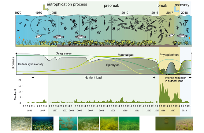
Pérez-Ruzafa et al.(2019)
- During the 1990s, agriculture started to change from dry crop farming with low amounts of nitrogen fertilizers to intensive irrigated crops with nitrogen fertilization, using waters diverted from the Tajo to the Segura river.
- From 1988 to 1997, nitrate concentrations increased from lower than 1 μmol N/l, throughout the year, to concentrations of up to 8 μmol/l1. By contrast, phosphate values, usually higher than 2 μM/l in 1988, seem now to be the limiting factor during most of the year. Comparative analyses between 1988 and 1997 revealed that, in spite of changes in nutrient input which stimulated the growth of larger phytoplankton cells, there were no significant differences in the pelagic size spectra slope which followed a similar seasonal trend among both years. The lagoon still maintained low phytoplankton biomass and without any significant increase in chlorophylla concentration (Pérez-Ruzafa et al., 2002). The maintenance of good water quality was due to the proliferation, since 1995, of mainly two alloctonous jellyfish species (Rhyzostoma pulmo and Cotylorhiza tuberculata) which have colonized the lagoon over the last decade – population was estimated at 40 million individuals- (Pérez-Ruzafa et al, 2002) and exert a top-down control of the trophic web. This situation has remained relatively stable for 20 years (Pérez-Ruzafa et al., 2019).
- The regulatory mechanisms of the lagoon became broken in spring of 2016, with the loss of water quality and strong regression of benthic macrophyte meadows, producing a high socio-economic impact. The Mar Menor lagoon reached a severe eutrophic stage, in which excess nutrients caused explosive growth of unicellular algae, which gave the water a greenish color preventing the passage of light to the deep areas (visibility in the water column was reduced from around 6 m to less than 0.5m and consequently the photosynthesis of the vegetation, leading to the mortality of the C.prolifera-C. nodosa mixed meadows located at more than 2m depth (Pérez-Ruzafa et al.,2018)(Pérez-Ruzafa et al. 2019). The loss of 85% of grasslands caused trophic imbalances and increased the oxygen demand for the decomposition of the organic matter of the bottom.
- The application of severe restrictions to nutrient inputs on the basis of a detailed scientific monitoring program permitted the recovering of the ecological equilibria by the first half of 2019.
- However, unfortunate events of especially virulent floods on September 2019 caused by an Isolated Depression at High Levels (DANA) generated enormous entrance of fresh water to the lagoon, causing massive fish mortality due to the generation of anoxia conditions.
- Comparing current data with same date of 2019, indicators has changed in transparency (5.17->3.2m), turbidity (1.44->10.06FTU), chlorophyll (0.3->7.59μg/l), salinity (43.47->38.46PSU). Temperature and oxygen concentration keep same values.
After two more episodes of vast floods on December 2019 and January 2020, current status of Mar Menor could be checked by analysing its main indicator levels.
The Mar Menor for transplanting experiments
Despite of the harmful floods and increase of turbidity and chlorophyll levels, the Mar Menor meets optimal conditions for transplanting experiments of the C. nodosa meadows.
C. nodosa has been present in the lagoon since there are records 100 years ago (Butigieg, 1927, Lozano, 1954, Pérez-Ruzafa et al.,1987) and has inhabited both the muddy deep areas of the lagoon, and the shallow sandy ones, where it reaches its maximum development and the highest densities.
Its capacity to recover from anthropic impacts is valued, as evidenced by its recovery after the filling actions of beaches carried out in the 1980s that buried some of them, recovering their previous densities between 10 and 15 years later.
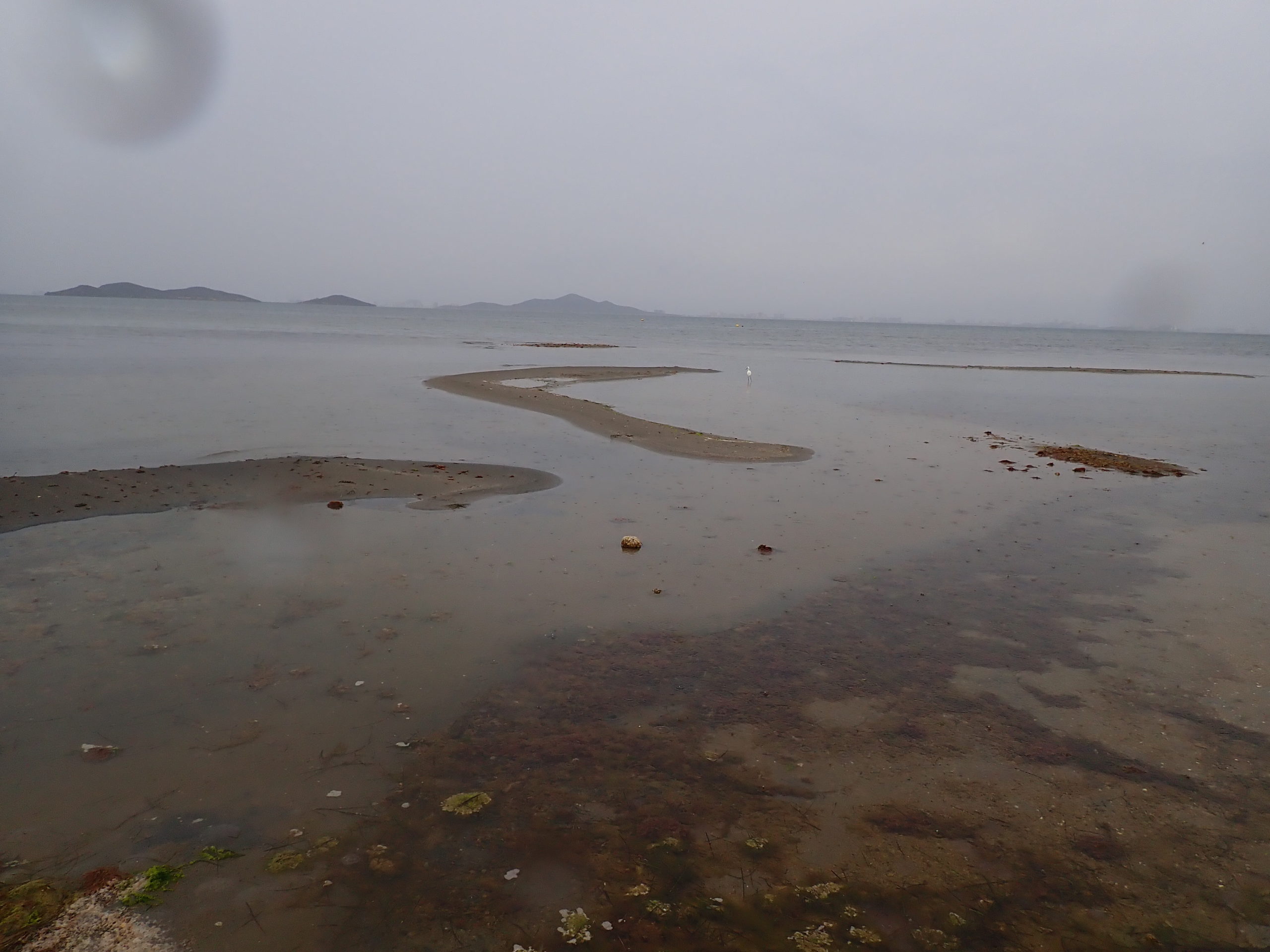
The current formation of sandy banks and muddy areas with too low hydrodynamics, that put them in danger, takes place in specific areas and transplants can be done to unaffected areas and subsequently, once stabilized and carried out the elimination actions of said sand banks and recovered the hydrodynamic conditions of the affected areas, would be reintroduced into their original environments to help their recovery.
Safeguarding these meadows is essential to be able to recolonize and recover other areas subject to other types of impact in the lagoon in the future.